Project Overview

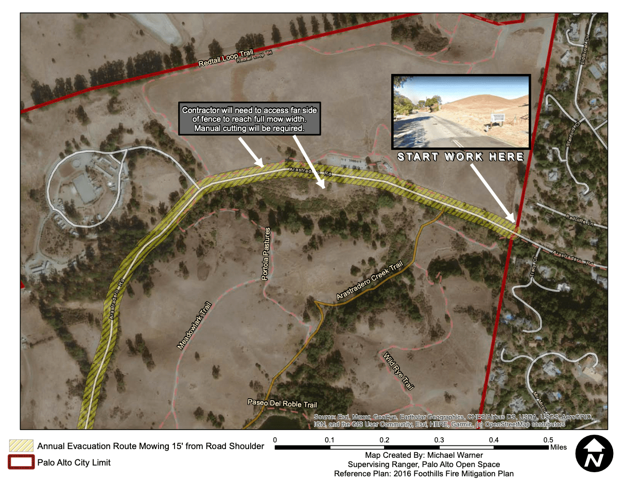
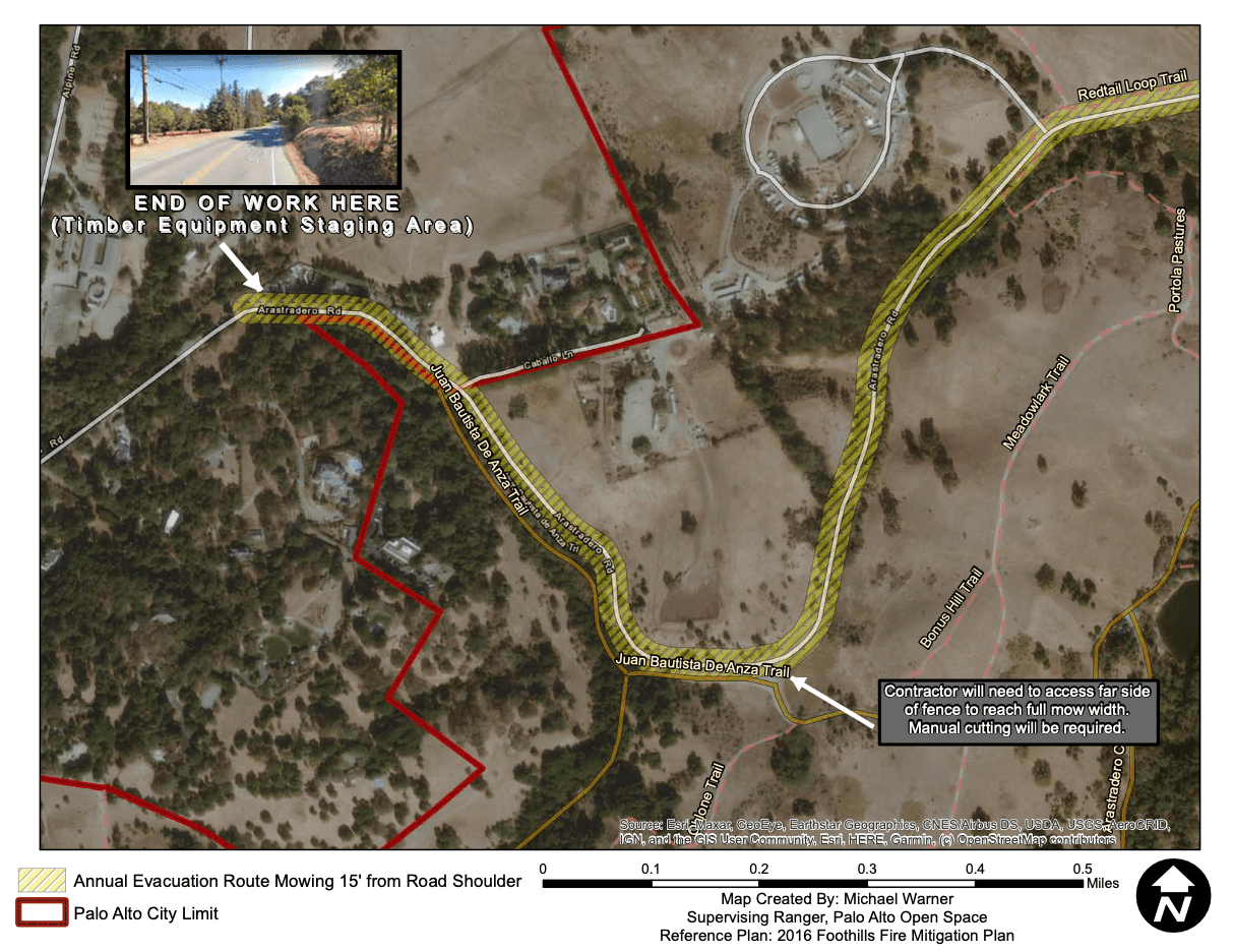
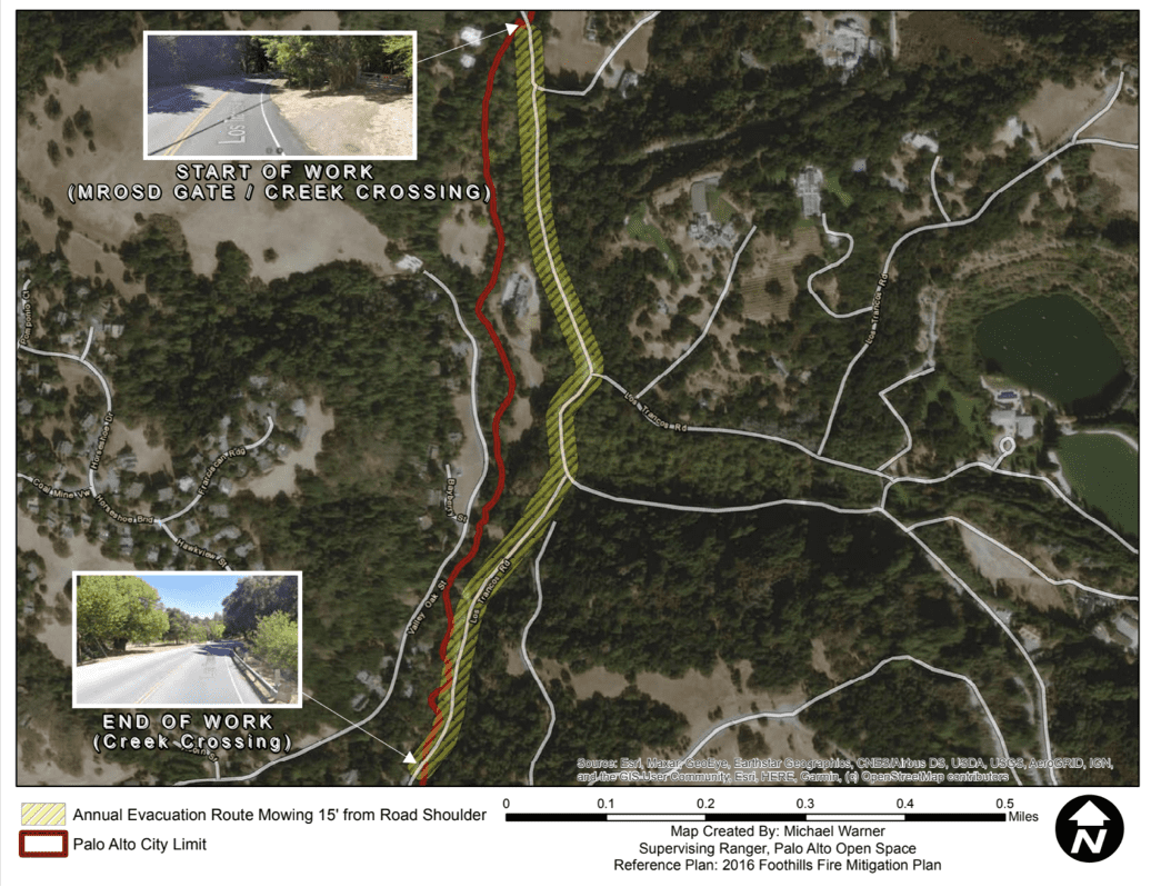
Santa Clara County Fire Safe Council and the City of Palo Alto are collaborating to complete a roadside mowing clearance project on Arastradero Road and Los Trancos Road, located in the foothills of the Santa Cruz Mountains west of Highway 280. This annual project enhances fire resistance along the evacuation route by reducing vegetation in the corridor and supports safer travel in emergencies.


The Santa Clara County Fire Safe Council works with the City of Palo Alto to coordinate fire fuel reduction projects across jurisdictions between partner agencies. This work is in alignment with the Foothills Fire Management Plan, which is overseen, coordinated, and funded by the Palo Alto Fire, Public Works, Utilities, and Community Services departments.

When

The SCCFSC is planning to complete the project from August 11, 2025, through August 22, 2025

Work will take place on weekdays from Monday through Friday, from 9 a.m. to 3 p.m. Please expect travel delays as work crews will conduct traffic control for single lane closures.

Where

Arastradero Road

It will start at the entrance of the Arastradero Preserve on Arastradero Road (37°23’08.6″N 122°10’13.8″W) and continue for approximately 1.8 miles, ending at the border of Palo Alto and Portola Valley (37°23’05.2″N 122°11’21.4″W). The project area information is illustrated on the project maps that follow.

Los Trancos Road

The Los Trancos Road portion will start at the entrance of one of the Midpeninsula Regional Open Space District gate on Los Trancos Road (37°22’17.3″N 122°12’04.0″W) and continue for approximately 0.7 miles, ending at the border of Palo Alto and Portola Valley (37°21’45.1″N 122°12’09.8″W). The project area information is illustrated on the project maps that follow.