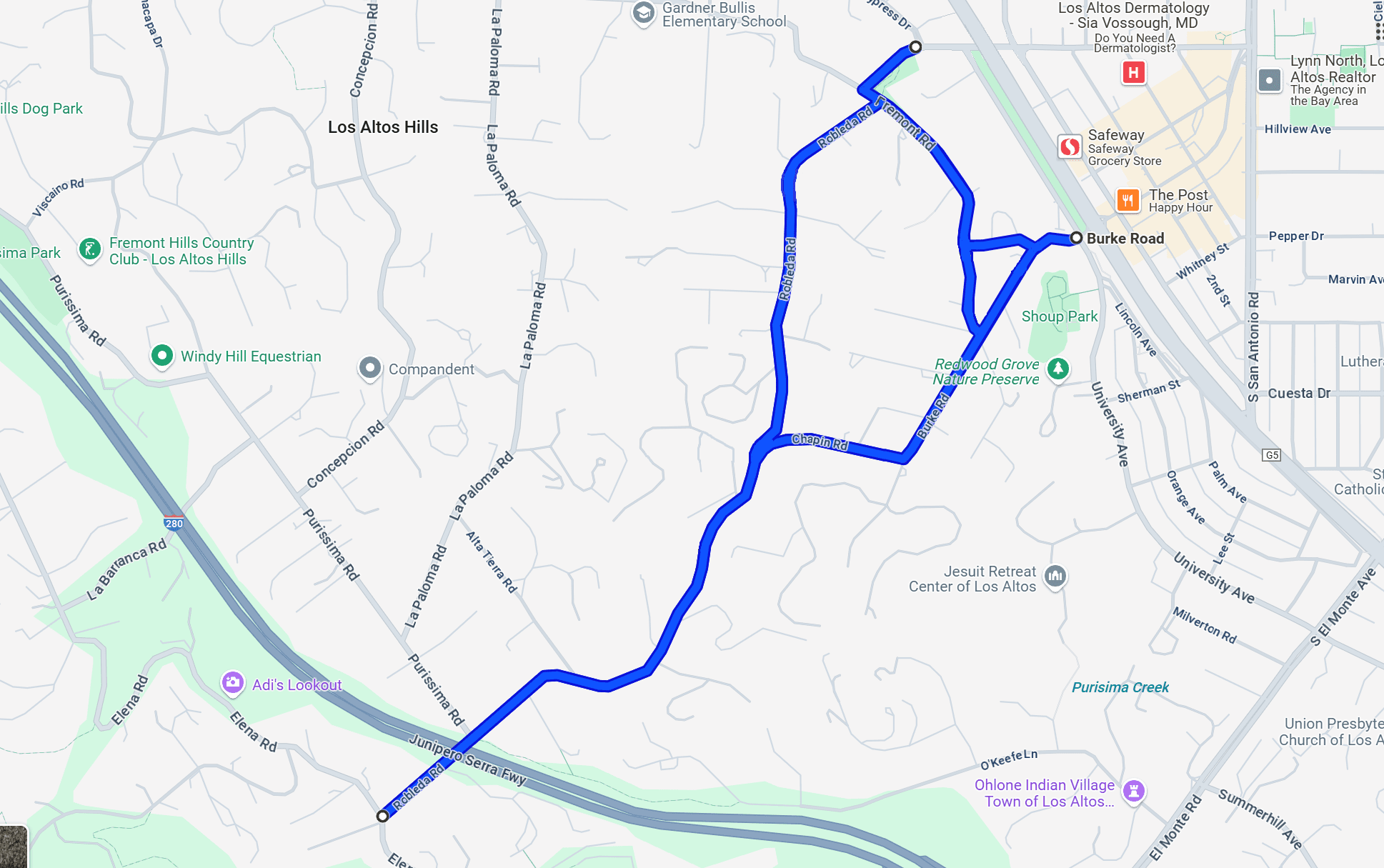
Portions of the Robleda-Burke evacuation route maintenance project represent a significant
thoroughfare for the central Los Altos Hills Community. These roads serve as egress and
ingress for local residents, daily commuters, and emergency services. To secure the egress /
ingress’ integrity, the Los Altos Hills County Fire District proposes a roadside treatment of fuels.


Schedule

  • The project is tentatively scheduled to start Monday, November 3rd, 2025
  • Postcards will be mailed to homeowners along the route on September 12th.
  • Cover letters and permission forms will be mailed on September 19th.
Project Site
The Robleda-Burke project will treat six (6) roads along the evacuation route. These include Robleda Road, Chapin Road, Fremont Road, W. Edith Avenue, Burke Road, and Old Altos Road.
This project will treat the following sections of each road:
• Robleda Road: From the intersection of Elena Road (37.364907, -122.137449) to the intersection of Fremont Road (37.380174, -122.124167). Approx. 1.5 linear miles, 3.0 treated miles.
• Chapin Road: From the intersection of Robleda Road (37.372233, -122.127559) to the intersection of Burke Road (37.372521, -122.123477). Approx. 0.3 linear miles, 0.6 treated miles.
• Fremont Road: From the intersection of W. Edith Avenue (37.380451, -122.124609) to the intersection of Burke Road (37.375249, -122.121435). Approx. 0.43 linear miles, 0.86 treated miles.
• W. Edith Avenue: From the intersection of Fremont Road (37.380451, -122.124609) to the intersection of University Avenue (37.381296, -122.121895). Approx. 0.16 linear miles, 0.32 treated miles.
• Burke Road: From the intersection of Chapin Road (37.372521, -122.123477) to the intersection of University Avenue (37.377275, -122.118805). Approx. 0.44 linear miles, 0.88 treated miles.
• Old Altos Road: From the intersection of Burke Road (37.377095, -122.120003) to the intersection of Fremont Road (37.377128, -122.121805). Approx. 0.10 linear miles, 0.20 treated miles.
Total Treated Miles: 5.86